This is a very experimental map- hardly a map at all; more like an exercise or puzzle- fit the Soviet Union into a 2:1 rectangle. (Very roughly) it shows the great rivers, and the mountainous regions to the south and east, and hints at the glaciated regions in the north and the west. The top map shows the locations of the loess regions investigated by Jiri Chlachula (2003 The Siberian loess record and its significance for reconstruction of Pleistocene climate change in north-central Asia. Quaternary Science Reviews 22, 1879-1906). This is loess in Siberia.

That's the science in the top map; the lower map has some classification and deterministic speculation. The P symbols show locations of loess material production- by mountain glaciers or continental glaciation. Rivers carry this material towards places of deposition. The J regions are those places proposed by Jefferson et al in their classification of loess in the Soviet Union. Of course now that we are looking at loess in Russia we lose some of J1 the western loess, J2 the Caucasus, and J3 Central Asia. The J5, J6 and J7 regions contain the Chlachula observations.
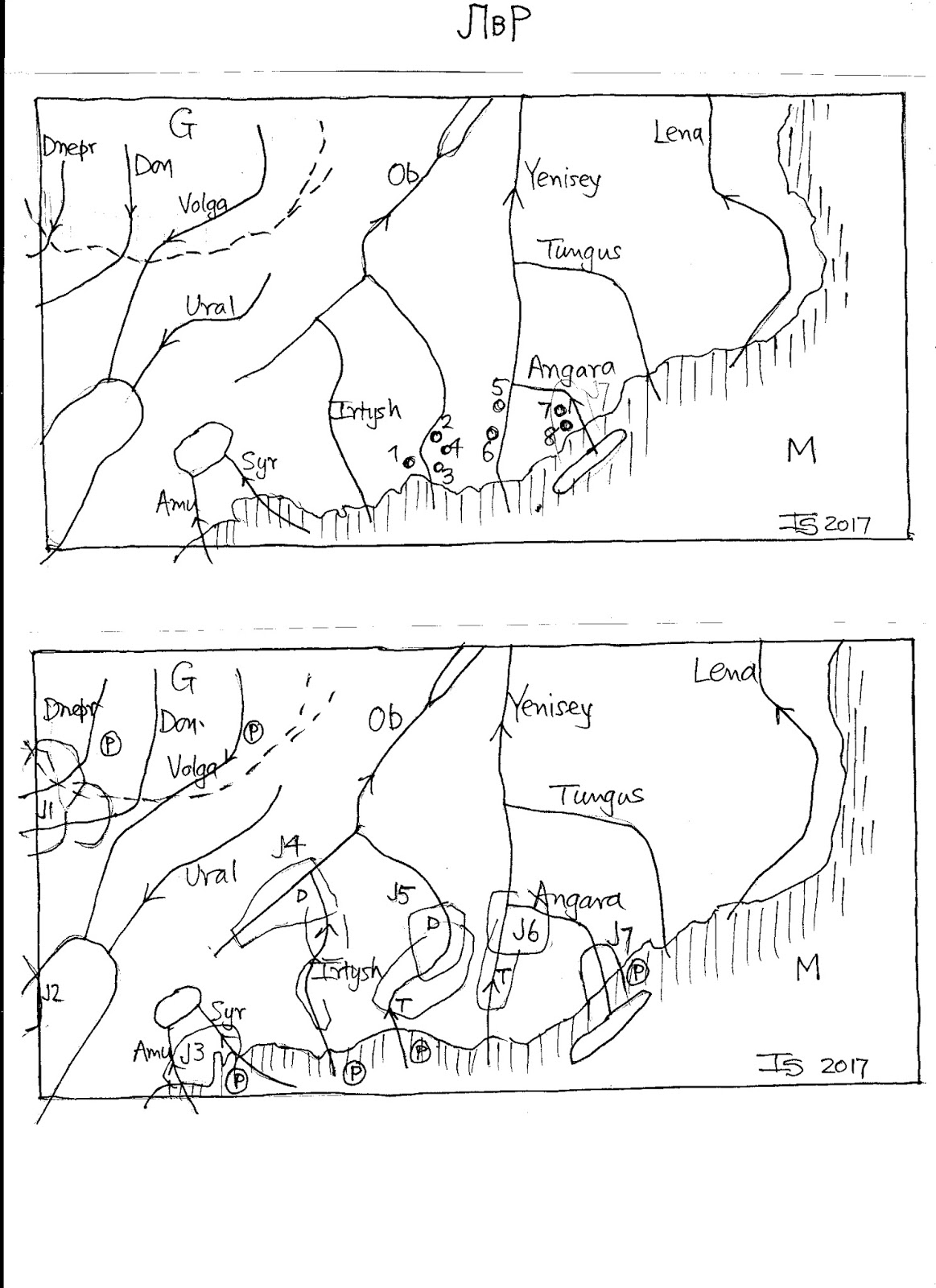
That's the science in the top map; the lower map has some classification and deterministic speculation. The P symbols show locations of loess material production- by mountain glaciers or continental glaciation. Rivers carry this material towards places of deposition. The J regions are those places proposed by Jefferson et al in their classification of loess in the Soviet Union. Of course now that we are looking at loess in Russia we lose some of J1 the western loess, J2 the Caucasus, and J3 Central Asia. The J5, J6 and J7 regions contain the Chlachula observations.
No comments:
Post a Comment